10 years ago, after many years residing in San Francisco, we moved to Berkeley, across the Bay. After years of regarding Berkeley and the East Bay as being closer to Europe than just across the bridge, we quickly changed our tune as we discovered the joys of the place. Berkeley might be regarded as a “streetcar suburb”, that is an older inner ring city , not as dense as the center city, but not fully suburban either. And that notion carried extra weight for us, as we did not own a car, so finding a home 2 blocks from the “streetcar” line into the San Francisco was important. We expected we would need to buy a car within a few months, but in the meantime, we bought bikes , and between that, the train, and our feet, found we could live fine without one.
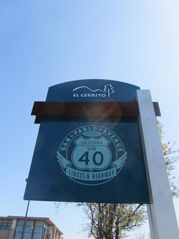
During that time, central to our errands was the nearby neighborhood commercial street, San Pablo Avenue. Running from downtown Oakland to the town of Crockett, this street is 23 miles long , a main artery that connects the various towns up and down the East Bay. I became fascinated by this street, in no small part because of the way it cuts through the strata of the metropolitan area, from urban, to suburban, to industrial, to rural. So I decided to walk the length of it, all 23 miles, during some downtime back in 2012. I documented the walk and wrote about it in a rambling post back then.

Eventually I did buy a car, but instead of a few months, it was a few years, 8 to be exact. The desire for a vehicle finally overtook a combination of my inertia, frugality, and half-hearted environmental statement. After 15 years in all without one, I was now a car owner. No more straining under the weight of heavy groceries walking home from the grocery store. No more trying to figure out how to take once an hour bus lines to access the ample wildlands of the area. Its been a good thing.

And then came 2020. Taking transit , a lifeblood for years, was not a desired option with COVID. The car became a necessity- occasional trips to San Francisco, random errands to work , for family trips to Southern California that helped avoid air travel , not to mention trips to the countryside for remote socially distanced ambles.
Recently, I was running errands, driving on the same San Pablo Avenue. On a whim, I kept going, and traversed those same 23 miles, and (after what seemed like an eternity), I arrived at the other end. Of course the street has a completely different character from the car, but I found myself reminiscing about that crazy walk. As I moved further out in the suburbs, the walk became more awkward, with the disappearance of sidewalks, the intimidatingly huge intersections. And the perilous final stretch on a shoulder-less road was downright dangerous. The whole endeavor seemed equal parts absurd and remarkable, and it was no small feat that I survived . As I drove in my socially isolated Mini Cooper, I was reminded that the car had been a god-send during the pandemic, but so had walking. After the initial abhorrence of what the urban amble had become in early 2020, a constant negotiation of distance from my fellow walkers, it had become a critical part of every day, a sanity saving breath of mask-filtered air in the neighborhood, and a much needed reprieve from working from home, or as I like to say, living at work. Sometimes a short jaunt, other times, an epic journey. And San Pablo Ave embodied both ends of that for me- the neighborhood errand as well as the 23 mile pilgrimage.
So I decided to celebrate it as a way of commemorating 2020. I created an 8 foot long map- 4 boards, each 2 feet long , that compile photos from the walk, tracing the route . The finished piece is oriented south to north, like the avenue, from Oakland to Crockett, and sits on a wall in that same orientation.

The first board documents the beginning , in downtown Oakland, past an array of fine urban buildings, some boarded up buildings, parking lots, and a number of storefront churches. The walk started in downtown Oakland’s City Hall, in the lower right.

The second board moves to Berkeley and other inner ring cities. This is our local stretch, a destination for many of those much needed “Covid-walks”. The real charm of the street though is all the one-off oddities, where one can find shops dedicated to typewriters, pianos, bait and tackle, bathtubs, and Halal groceries (we have 3 of those!), all housed in brightly colored shacks, log cabins , and repurposed theaters.

From here, the street becomes more suburban, parking lots grow, and buildings begin to turn away from the street. But the offerings can be no less esoteric , witness the button store.

And finally . the last ring, outer suburban to rural, with an oil refinery thrown in for good measure. It was on this day, having nearly met my demise on the last leg, that I staggered to the finish line and discovered the wonders of the Dead Fish, the restaurant that literally marks the end of the road. I am certain I am the first person to ever arrive there on foot.

Putting this together seemed like an apt act to end 2020. Urban walking this past year felt more necessary than ever. And it was also a year that I rediscovered the pleasures of having a vehicle, and ironically, it was while driving one day in that bubble, that I got the idea to create this. 2021, already a month old, promises to bring us back to more a familiar place…..I hope. And with it , I am finding a renewed energy to document a too long list of urban explorations in this space. Welcome 2021.